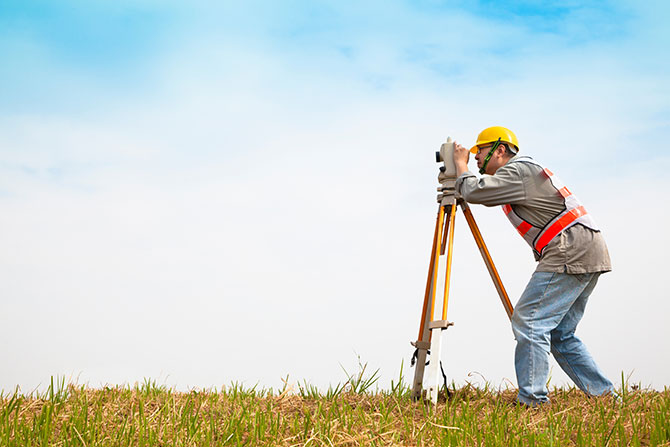
Over the years, I have heard many thoughts expressed about what a Land Surveyor is, from a person with a clipboard asking demographic questions used for compiling a statistical view anything, to the guy on the side of the road looking through the camera, to someone who knows and understands what a Land Surveyor does. The point is when people hear the title “Land Surveyor,” it varies depending on their background and experiences. Many people will never need the professional services of a Land Surveyor, but if you find yourself in need of one, this may help you.
The Merriam-Webster Dictionary defines surveying as “to determine and delineate the form, extent, and position of (such as a tract of land) by taking linear and angular measurements and by applying the principles of geometry and trigonometry.”
A Land Surveyor could then be defined as someone who performs the act of surveying. They could also be described as a professional who measures and maps the land and its natural and man-made features. Their primary function is to determine the features, location, size, and boundaries of tracts of land or properties, using mathematics, legal principals, together with specialized measuring equipment such as GPS, total stations, and laser scanners to collect data and create precise measurements and maps.
Many people only encounter a Land Surveyor when they are uncertain as to the location of the boundaries of their property. This uncertainty usually arises from questions about fence lines or other forms of occupation like hedges, concrete pads, building setback requirements etc. The ability for a Land Surveyor to accurately determine a boundary location is one of the reasons Land Surveyors should hold a professional license.
Some may associate Land Surveyors with the construction industry, where they play a vital role in preparing and laying out building and infrastructure projects. Land Surveyors can provide precise measurements, and site maps that are essential for site planning, grading, alignment and foundation work.
Land Surveyors also play a crucial role in Geographic Information System (GIS): data collection and mapping. GIS systems are used to manage and analyze geographical data and Land Surveyors can provide accurate data and mapping for a range of industries such as agriculture, environmental management, and urban planning.
Land surveyors may work for or with government agencies to ensure compliance with regulations and requirements related to land use and development as determined by local land use authorities.
Land surveyors must be skilled in using a range of tools, including hand tools, electronic surveying equipment, GPS and computer-aided design software.
Those who have encountered a Land Surveyor hopefully have had a positive experience and will trust and recognize Land Surveying as a highly technical and specialized profession that requires advanced knowledge of mathematics, property and boundary law, science and technology.
I am optimistic this will help you understand that a Land Surveyor is a highly skilled professional who provides essential services to a wide range of industries and individuals. They are regarded as experts in their field, and their work is crucial for property ownership, property rights, construction projects, GIS data collection and mapping and government regulations.
If would like more information about what a Land Surveyor is, you can contact me at andyh@greatbasineng.com or visit the Utah Council of Land Surveyors (UCLS) at www.ucls.org or talk to your local state surveyors organization, to find out more.


