


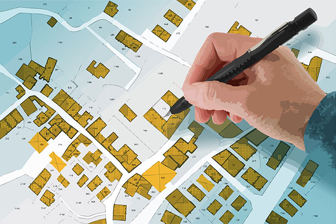

Accurate plats and surveys are the backbone of property ownership and development. They tell us where our land begins and ends, where easements run, and where future roads and utilities will go. In Utah, the process of preparing and recording subdivision plats is governed by a combination of statutes, professional standards and best practices designed to protect property owners, developers and the public.
This article explores the key rules found in Utah Code §§ 17-23-17, 17-27a-603, 10-9a-603, Title 58 Chapter 22 and Section 5 of the Utah Council of Land Surveyors (UCLS) Final Subdivision Plat Guidance Document — and explains why they matter.
Boundary Surveys and Records of Survey
When a professional surveyor establishes or re-establishes a property boundary, they must prepare a map of boundary survey, also known as a record of survey.
Utah Code § 17-23-17 requires this map to be filed with the county surveyor (or other designated office) within 90 days of completing the survey. The map must include:
- All monuments found or set
- Bearings and distances between control points
- Ties to section corners or other recognized control monuments
- Adjoining parcels and relevant notes
Filing the record of survey ensures the boundary data becomes part of the public record, reducing future disputes and giving other professionals a reliable reference point.
UCLS Section 5 builds on this requirement with practical recommendations: verify exterior boundaries early in the process, clearly depict connecting roads and easements, and use distinct subdivision names and consistent lot numbering across phases. Following these best practices helps avoid costly rework during final plat review.
When a Plat Is Required
Whether you are subdividing in a rural county or an incorporated city, Utah law requires an accurate plat when land is divided into lots.
- In Counties (Unincorporated Areas): Utah Code § 17-27a-603 applies.
- In Municipalities (Cities and Towns): Utah Code § 10-9a-603 applies.
Both sections are nearly identical and require the plat to show:
- A subdivision name that is unique within the county
- Lot, block and parcel boundaries with bearings and dimensions
- Street names, rights-of-way, easements and dedications
- Lot numbers
The plat must also be signed and sealed by a licensed surveyor, signed and acknowledged by all owners, and approved by the appropriate local authorities. Counties and cities must coordinate with culinary water, sewer and fire authorities, and utility owners must verify the location of underground facilities before final approval.
Once approved, the plat must be recorded in the county recorder’s office within the time specified by local ordinance. Failure to record on time makes the plat voidable, which could mean having to repeat the approval process.
Licensed Professionals and Surveyor Certifications
Utah’s Professional Engineers and Land Surveyors Licensing Act (Title 58, Chapter 22) makes it clear: Only licensed surveyors may perform boundary surveys, prepare plats or certify their accuracy.
Plats must bear the surveyor’s seal and certification stating:
- The surveyor is licensed in Utah
- The plat complies with Utah Code § 17-23-17 (map of boundary survey requirements)
- Monuments have been set or will be set as shown
This seal carries legal weight — falsifying a plat or misusing a seal can result in disciplinary action, fines or even loss of license. The law also requires continuing education to keep professionals up to date with surveying techniques and regulatory changes.
Timing and Compliance
Two deadlines are especially important:
- 90-Day Filing Requirement: Records of survey must be filed within 90 days of completion.
- Plat Recording Deadline: Once approved, plats must be recorded promptly, typically within a few months as set by local ordinance.
Missing these deadlines can lead to delays, additional review cycles or invalidation of the plat — costly mistakes for developers and property owners.
Exemptions and Special Cases
Not every land division triggers a full subdivision process. Some examples of exemptions:
- Minor lot line adjustments
- Certain agricultural land divisions
- Small subdivisions that meet county-specific “minor subdivision” thresholds
Even with exemptions, it’s wise to check with the local planning department to determine whether a simplified plat or survey is still required.
Risks of Non-Compliance
Failing to follow Utah’s subdivision and survey requirements can have serious consequences:
- Legal disputes over boundaries or easements
- Recording delays that hold up sales or construction
- Penalties for unlicensed practice or late filing
- Additional costs for redesign or resurveying
Compliance isn’t just a legal obligation — it’s a way to protect your investment and prevent headaches down the road.
Conclusion
Utah’s subdivision plat and survey laws are designed to balance private property rights with public interests. By requiring accurate surveys, licensed professionals and proper recordation, the state ensures that land development proceeds in a way that is clear, fair and consistent.
For developers, surveyors and landowners, the takeaway is simple: Start early, work with qualified professionals, and follow the filing and recording timelines. Doing so avoids costly surprises and keeps your project on track.
For more information, visit the Utah Legislature’s website at le.utah.gov or consult the UCLS Final Subdivision Plat Guidance Document.
Todd Jacobsen has worked for the City of St. George, Utah, for 23 years and currently serves as the city surveyor. Before joining the city, he spent three years in the private sector as a draftsman and survey crew chief. With 26 years of experience, Todd has been an integral part of one of the fastest-growing communities in the nation. For the past 11 years, he has served on the Executive Board of the Utah Council of Land Surveyors (UCLS), including six years as the Color Country Chapter president and three years as state chair elect, state chair and past chair. He now represents the Color Country Chapter as its chapter representative. Todd and his wife of nearly 31 years have three children, with the first grandchild on the way.
🗹 Utah Subdivision Plat and Survey Checklist
Before Surveying
- Confirm property description and deed boundaries
- Research adjoining surveys and section corners
- Verify subdivision name is unique in county
During Survey
- Monument or reference all corners
- Prepare map of boundary survey (record of survey)
- File with county surveyor within 90 days
Preparing the Plat
- Show boundaries, lot dimensions, easements, rights-of-way
- Assign unique lot/block numbers and addresses
- Depict existing and proposed utilities
- Obtain utility owner verification (underground facilities)
- Get approvals from water, sewer, fire and planning authorities
- Secure property tax clearance
Surveyor Certification
- Affix professional seal and signature
- Certify compliance with Utah Code § 17-23-17
- Confirm monuments are set (or will be set)
Final Steps
- Obtain owners’ notarized signatures
- Record plat in county recorder’s office before local deadline
- Keep a copy of the recorded plat for project records